Wk 3 // digital upskilling: QGIS, satellite data, and topography + Te Uru
- Mar 13, 2023
- 2 min read
As well as making my own "geographies" via LiDAR and photogrammetry, I've recently found a way to import satellite information directly into Blender from sources like Google, Bing, etc. I'm still familiarising myself with it, but it basically allows me to import geological data relating to different places (topographies, land heights, building/structure locations, etc.).


I've also come across a program called QGIS - "a free and open-source cross-platform desktop geographic information system (GIS) application that supports viewing, editing, printing, and analysis of geospatial data." Similarly, it allows me to download geographical information sets to work with, mostly from satellite data. Some of the images coming out of it are really beautiful and dreamlike in the amount of detail they show, and I'm currently following a tutorial around how I can put this to use in Blender to create workable images.


The examples above were created using free-to-access data relating to the North Island - the top left is a raster file with minimal editing, the bottom left has a topological modifier applied to emphasise the slopes in the land, and the bottom right is a zoomed in portion above the Central North Island. I'm enjoying the almost visceral feel the images have (the waterways especially feel very nerve- or vein-like to me), and the play with scale and perception. As images, and as data sets beyond what is perceivable to the human eye on a day-to-day basic, they feel very different to how I'd usually imagine an aerial 'landscape'; and a vibrancy/thingness/energy that I think could be explored (non-static earth, scales beyond human perceptions, etc.)...
I also attempted some basic topology line effects (upper right image above), but I'm not completely happy with it at present... Like the others, I think there's potential to make them something interesting, but I have a lot to learn and for now the QGIS and satellite information possibilities feel more productive.
Te Uru Portage Ceramic Awards
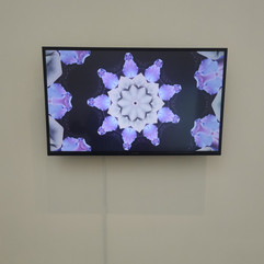
I've been looking forward to this exhibition for a while and managed to catch it on the last day it was open last week. It was magical seeing the different responses and styles of ceramic artists in this exhibition. Clay is an unfamiliar medium for me, and the diversity of works present really helped challenge some deep set ideas about what ceramic art can be that I didn't realise I held until walking in. Was also really intrigued by Teresa Peters' Time Crystal (video work) and her combination of ceramic, sound and moving image...


Cellular memories and planetary designs - Elizabeth Thomson


Comments